|
|
PREFACE In September 1912, Carl G. Fisher, president of
Prest-O-Lite Company of Indianapolis, Indiana, conceived the idea of
constructing a "hard-surfaced, improved highway" from the Atlantic to
the Pacific. He called his idea "The Coast-to-Coast Rock Highway," and
it was Fisher's hope that he would find financial support from leaders
of the automotive industry to build this first transcontinental
automobile route. Fisher's company manufactured the lighting systems
that were used on many automobiles of that day, and being "an
enthusiastic motorist in his own right" (he was also founder of the
Indianapolis Motor Speedway), understood the need for good roads at
that time.
Later that same year, Henry B. Joy, president
of Packard Motor Car Company, would propose to Fisher that this
coast-to-coast highway also serve as a memorial to the beloved fallen
president, Abraham Lincoln. As an "appeal to patriots," Joy's idea was
well-received, and on July 1, 1913, in Detroit, Michigan, the Lincoln
Highway Association was officially organized, with Joy being elected
as its first president. The actual route of the Lincoln Highway had
not yet been decided upon, but after two months of careful
consideration, a route was eventually announced to the public on
September 14, 1913. As it appeared in the original proclamation, the
route across Ohio was "described as passing through...Canton,
Mansfield, Marion, Kenton, Lima, Van Wert, [on the route] known as
Main Market No. 3."
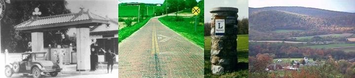
The texts that follow contain both the history
of the Lincoln Highway, as it pertains to Ohio, and a road guide for
the different versions of the route across the state, as it was marked
by the Lincoln Highway Association between 1913 and 1928. In addition
to the road guide, a set of both westbound and eastbound odometer
charts have been included, plus a set of 23 strip maps. A section of
appendixes, which includes miscellaneous maps, charts, and other items
of interest, completes this internet edition.
It is this author's hope that the reader will
not merely make a "paper journey" of this historic route as it travels
across these pages, but that he/she will truly tour this route as it
traverses more than 240 miles across the Buckeye State. Instead of
driving straight through each town, stop for a while and get to know
that particular place-- stroll the sidewalks; browse in the shops and
museums; have lunch with the locals.... Endeavor to experience the
feeling of "Main Street Across America" that Drake Hokanson so aptly
describes in his definitive history of the Lincoln Highway, and use
this road guide to find the way.
It is also this author's hope that the reader and traveler will be inspired to participate in the work of the new Lincoln Highway Association, which today purposes to "create popular awareness of and concern for the preservation of the Lincoln Highway." Information about membership is included in the blue brochure at the front of this book, and we look forward to hearing from you. ACKNOWLEDGEMENTS This project could not have been completed
without the contributions of many kind people and members of the
Lincoln Highway Association. A most special word of thanks is due to
Esther M. Oyster, who so generously shared copies of her extensive
research from historical archives in Columbus and Ann Arbor, and from
newspapers in eastern and central Ohio. Thanks are also due to those
who contributed a map or book or post card copy, or some other piece
of information that was vital to the road guide project.
Alphabetically, this list includes Richard Boehr, Brian Butko, David
Cole, Bob Ebbeskotte, Ray Gottfried, Jack Kerstetter, Hal Meeks, Don
Priess, Russell Rein, Jim Ross, Larry Webb, Mike Weigler, and Abe
Yalom.
DEDICATED to my children, Michaela Noelle and Michael Karl |
