|
HOW TO
USE THESE MAPS:
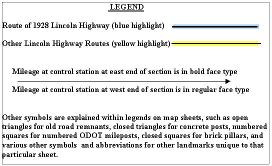
The 23 strip maps which
(will soon) follow should be used with the eastbound and
westbound odometer charts (also not yet available) to help the
Lincoln Highway traveler navigate the different sections of the
Lincoln Highway route across Ohio. It is understood that the endpoint
towns of each section are generally the largest towns on the route,
and thus offer the most complete tourist facilities, including gas,
food, and lodging. The 1990 populations of the largest cities and
towns on the 1928 route are listed below, plus the populations of the
four largest communities on the bypassed routes. For convenience in
navigation, the author recommends inserting the appropriate
eastbound or westbound odometer chart opposite the
corresponding strip map, eliminating the annoyance of flipping pages
from one part of the book to the other.
1990 POPULATIONS OF THE
1928 ROUTE
(• denotes county
seat)
|