|
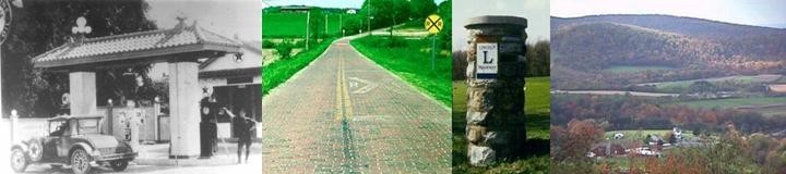
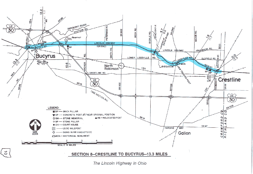
SECTION 8—CRESTLINE TO BUCYRUS—13.3 MILES The 1928 route of the Lincoln Highway between Crestline and Bucyrus features several of the best landmarks on the entire transcontinental route. With two brick pillars in Crestline, and one brick pillar near Bucyrus, plus both the stone monument and stone pillar at the east edge of Bucyrus, there is no other section in Ohio with so many excellent landmarks still in place.
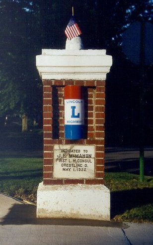
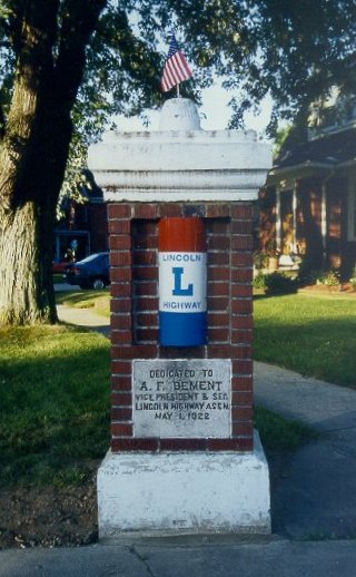
The two brick pillars in Crestline are at the intersection of Main
Street (the route of the Lincoln Highway) and Clink Boulevard.
According to Esther M. Oyster, past-president of the Lincoln Highway
Association, "[the pillars] were erected by C.A. Stephan to enhance
the entrance to his housing development." Both of these monuments were
dedicated May 1, 1922, as indicated by the dates shown on the embedded
concrete plaques. The marker on the southeast corner was dedicated to
J.F. McMahon, the first Lincoln Highway consul in Crestline; the
marker on the southwest corner was dedicated to Austin F. Bement,
vice-president and secretary of the Lincoln Highway Association. Both
pillars have been vandalized since their original construction, each
losing its original curved enamel sign, plus an ornamental lighted
globe on top. The McMahon plaque, for whatever reason, was found
broken several years ago. However, the main parts of both pillars,
including the damaged plaque, have been lovingly restored and cared
for by members of the Mid-Ohio Chapter of the Lincoln Highway
Association, and also by good neighbors in Crestline. Because of
repeated vandalism, the original curved porcelain signs have been
removed from the pillars,
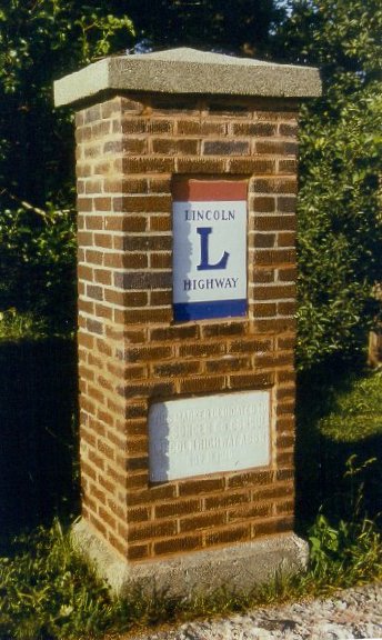
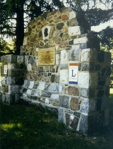
The brick pillar near Bucyrus is at the northwest corner of Stewart Cemetery, at 2.65 miles east of the town square. Interestingly, this monument was moved to its present location in 1920, when the Lincoln Highway between Mansfield and Bucyrus was rerouted from an alignment through Galion to an alignment through Crestline. The original location of this pillar was on what is now Hopley Avenue/State Route 19, just east of Whetstone Street, near the Bucyrus city limits. It was dedicated to E.J. Songer, Crawford County consul, on November 11, 1918. Another monument on what is now State Route 19 was dedicated to F.A. (Frank) Seiberling, president of the Lincoln Highway Association. This monument was one mile east of the original location of the Songer Marker, at a place known locally as the Holmes Curve, but its fate is unknown. The unique stone monuments in Bucyrus are both on the golf course
property, one
Just west of the Hopley Memorial is this stone
pillar. Perhaps the pillar was built from stones that were left over
after the memorial was built.
Another Lincoln Highway monument in this section is one of the concrete posts placed by the Boy Scouts. This marker is at the west end of Leesville Road, where it intersects U.S. 30, at the southwest corner of the intersection. The post was relocated to its present position, and is not in its original location. Because the post has been broken, the marker appears very short and is easily missed—watch for it at the east side of the utility pole on the southwest corner of the intersection. Because Leesville Road was a part of the 1928 Lincoln Highway alignment, it has been made a part of the charted course. This renders a temporary diversion from U.S. 30 of about three miles, and although it is a pleasant departure from the federal highway, there are dangerous turning movements at each end of its length. Leesville Road became part of the transcontinental route in December 1920, when the route from Mansfield by way of Galion was abandoned in favor of the route by way of Crestline. The newer version of U.S. 30, which we might call the "Leesville Bypass," was constructed in the 1930s. The present U.S. 30 bridge over the Sandusky River was part of that project, and is the third bridge to span the river in this area. The present steel truss bridge at Leesville Road is the second bridge, and long ago replaced a first bridge which was slightly downstream. The original alignment, now almost forgotten, is easier to trace during the winter months when the trees are bare. Two points of interest are on Leesville Road. First is a monument to Colonel William Crawford, who was sent into the Northwest Territory in 1782 to quiet remnant bands of Delaware Indians who had allied themselves with the British. These Indians had been infuriated by the massacre of innocent Moravian Indians by Colonel David Williamson and his army at Gnadenhutten, Ohio, and got a measure of revenge at the expense of Crawford and his army. Crawford was captured at or near this site, then was taken to the present site of Upper Sandusky where he was tortured and burned at the stake. A second point of interest is now the J&M Trading Post, managed by the Joe and Nancy Everly family—members of the present-day Lincoln Highway Association. The oldest part of the building dates back to either 1829 or 1830, when Rev. Robert Lee founded Leesville and built a general store which would serve the community for about 130 years. The site was placed on the National Register of Historic Places in 1979. Historically, much of this route originated in the 1820s as part of an early road between Mansfield and Bucyrus. In the 1910s, the section between Crestline and Bucyrus was designated Inter-County Highway #203, or Bucyrus-Crestline Road. In the early 1920s, it was also designated as part of State Route 5. In later years, the route became U.S. Route 30-N, and eventually U.S. Route 30, a designation which exists over most of this roadway today.
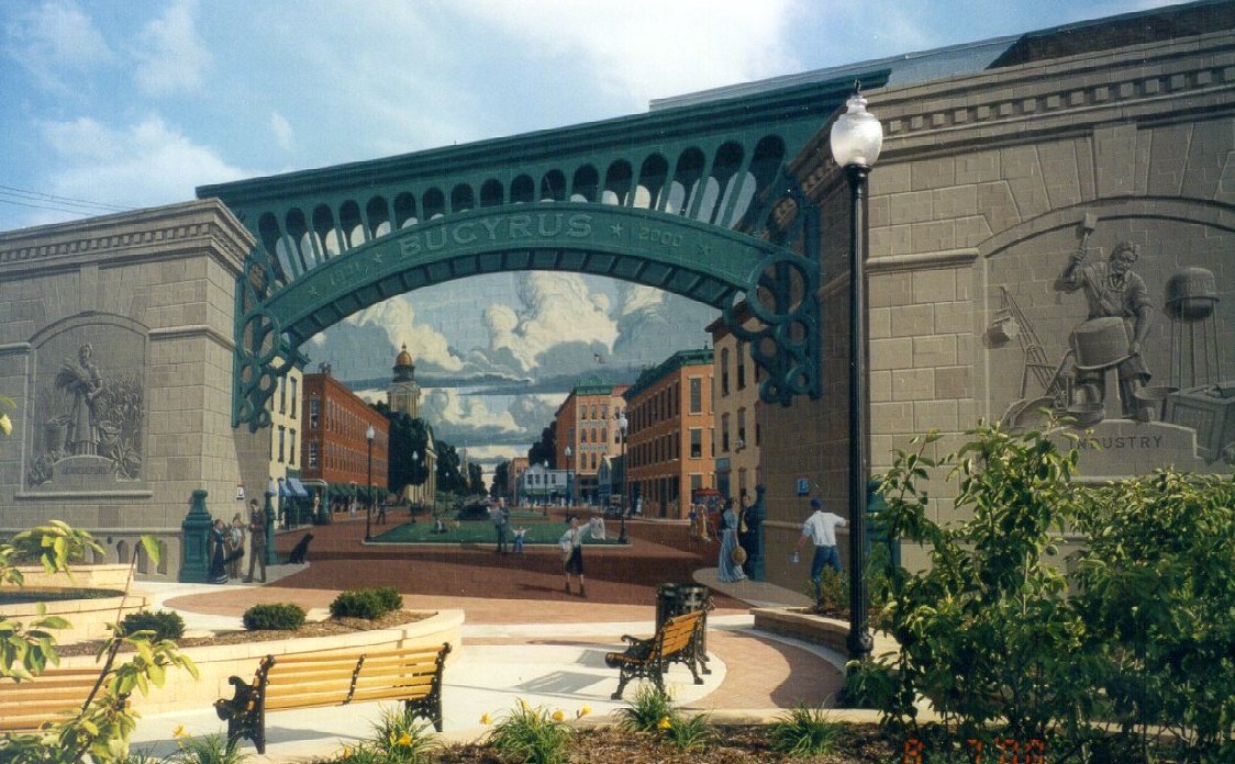
As of this writing, the city of Bucyrus is the only part of this section to have been bypassed with a limited access project of U.S. Route 30. This four-lane segment, with four interchanges, was opened in the early 1970s. However, potential future four-lane alignments that would pass to the south of Crestline are presently being discussed. Except within corporate limits, the 1928 route through Crawford County is officially designated as Lincoln Highway. Within the village of Crestline, the route is marked Main Street, and within the city of Bucyrus, the route is Mansfield Avenue. Near downtown Bucyrus, watch for the traditional red, white, and blue Lincoln Highway signs in the abutment walls of the railroad viaducts. There are three separate viaducts, and the two outside viaducts each have one sign which faces oncoming traffic. Watch for these signs carefully, as they are well-worn, and sometimes obscured by vegetation. |
