IN SEARCH OF . . .
THE DIXIE HIGHWAY
Michael G.
Buettner
February, 2006
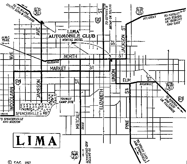
This map of Lima is from the 1927 Automobile Route Book. The numbering of the federal highway system became effective in Ohio in 1927, and this is the first guide book in my limited collection that shows the shields of U.S. Route 25. Between 1923 and 1926, the Ohio Department of Highways would have marked the roadway with a black on yellow State Route 6 sign below a rectangular black on yellow road name sign. Prior to that, the white-red-white symbol signs of the Dixie Highway would have been used to trace the route. Based on this map, the routes of the Dixie Highway/U.S. 25 followed Jackson Street, North Street, and Metcalf Street through Lima—the same course that is charted in the main text.